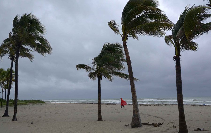
Hurricane Matthew weakens as it moves to the north
Jose Paseta, of Hallandale, Fla., walks along Hollywood Beach amid the lead elements of Hurricane Matthew on Thursday, Oct. 6, 2016. (Michael Laughlin/Sun Sentinel/TNS)
October 7, 2016
ORLANDO, Fla. — A slight wobble in the track of Hurricane Matthew early Friday morning may have saved Florida from potentially catastrophic conditions and instead turned the storm into a major — but still dangerous — wind-and-rain machine.
The storm’s eye has become slightly disorganized as it dropped to a Category 3 hurricane with winds of about 120 mph. At 11 a.m. EDT, the center was located about 35 miles off the coast of New Smyrna Beach as the storm chugged north toward Jacksonville and the neighboring state of Georgia.
Residents of south and central Florida awoke to find high winds and minor flooding but none of the devastation that occurred in Haiti, where the death toll is expected to rise to more than 400. Rescue workers there have been cut off from the hard-hit southwest peninsula, where images show flattened buildings and widespread destruction, the result of 140 mph winds.
Advertisement
No major damage was reported in southern Florida. Gov. Rick Scott said that Florida Fish and Wildlife officers are conducting searches in areas where the storm has passed, and no issues have been found. He also said Florida Highway Patrol has not reported any problems. Scott added that no fatalities have been reported.
Both the Miami and Fort Lauderdale airports as well as the Port Everglades cruise ship terminal were expected to reopen on Friday. Power was already being restored to parts of South Florida.
In central Florida, the Sanford-Orlando Airport was expected to remain closed all day, but it was hoped that the larger Orlando International Airport would be able to have limited service by day’s end. Disney World closed for only the fourth time in its history. Sea World and Universal were also closed on Friday.
Central Florida will continue to deal with Matthew on Friday morning, though forecasters said the area “dodged a bullet” because the strongest part of the storm stayed offshore.
“There was no landfall,” said Scott Kelly, a meteorologist for the National Weather Service in Melbourne, Fla.
Cape Canaveral was slapped with gusts of 115 mph around 5 a.m., and the more populated Melbourne area reported winds of 77 mph. Kelly said the weather service expects coastal areas and barrier islands to take the worst of the storm.
Most of the damage in Brevard County, which for decades has been the home to the space program, was restricted to blown-out windows and downed trees and power lines.
Advertisement*
More than 500,000 people were without power in the state, including at least 180,000 — half the population — in Brevard County.
The storm passed off the coast of Daytona Beach by late-morning as it was making its way north to Jacksonville. There were reports of trees falling on houses and some roofing torn off in Volusia County, but no damage assessment was immediately available.
The major concern Friday morning was storm surge, which could reach 10 feet. Georgia and South Carolina seemed especially vulnerable as the U.S. coastline jogs significantly to the east.
“We are very concerned about the storm surge and the worst effects are still likely to come,” Scott said. “Remember, Jacksonville has a lot of low-lying area, especially Nassau County. We’re very focused on Jacksonville and there is concern of significant flooding there.”
The storm was expected to be off the coast of Jacksonville no later than 8 p.m.
President Barack Obama, speaking from the Oval Office, warned that the situation is not over, but credited the governors of the four states that may be affected for being on top of things.
“I just want to emphasize to everybody that this is still a dangerous hurricane,” Obama said.
“We can always replace properties but we can’t replace lives. Even though the damage in south Florida was not as bad as it could be, there are people who have been affected and they are going to need help.”
The storm was originally expected to have a greater and more dangerous impact on the state. Scott had warned residents that the storm was capable of killing, causing local officials to close schools and public buildings well in advance.
Scott credited that preparedness as a key to the lack of significant damage.
“There is no victory lap yet,” Scott said. “There won’t be that until the storm leaves the state … and everyone’s lives return to normal.”
Counties opened 145 shelters, which housed about 22,000 people Thursday night.
Many central Florida communities imposed curfews, which will stay in effect until 7 a.m. on Saturday.
The Orange County sheriff’s office said two people were arrested for violating curfew and in nearby Sanford, a man was arrested for trying to break into a Dollar General store.
___
(c)2016 Los Angeles Times
Visit the Los Angeles Times at www.latimes.com
Distributed by Tribune Content Agency, LLC.
Advertisement


